
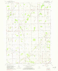
1963 Map of Colling
USGS Topo · Published 1965About this map
Colling and Columbia Corners anchor this agricultural landscape in the early 1960s, defined by a dense network of drainage canals and established farmsteads. The importance of local social infrastructure is evident through the placement of St Peters Ch and Bethel Ch, alongside small rural education centers like Parsell Sch and Almer Center Sch. Transportation in the region is dominated by the intersecting routes of the Chesapeake and Ohio and New York Central railroads, which facilitated the movement of goods through the central Michigan plains.
Find a feature on this map
52 named features on this map. Tap any name to fly to it.
Don’t see what you’re looking for? This feature index may not catch every label — zoom into the map to look around manually.
Map Details
Editions of this 1963 Colling Map
2 editions found
Other maps of this area

1954 · Flint
USGS Topo · 1:250,000

1958 · Flint
USGS Topo · 1:250,000

1963 · Fish Point
USGS Topo · 1:24,000

1963 · East Dayton
USGS Topo · 1:24,000

1963 · Fairgrove
USGS Topo · 1:24,000

1963 · Ellington
USGS Topo · 1:24,000

1963 · Gilford
USGS Topo · 1:24,000

1963 · Caro
USGS Topo · 1:24,000

1963 · Owendale
USGS Topo · 1:24,000

1963 · Sebewaing
USGS Topo · 1:24,000