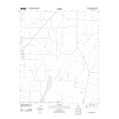
2012 Map of Collinston East
USGS Topo · Published 2012About this map
Collinston sits at the western edge of this Morehouse Parish landscape, where the local economy transitions from the town's street grid to a dense network of agricultural roads and waterways. The drainage pattern is defined by the meandering courses of Little Bayou Bonne Idee, Bayou Galion, and Bayou Coulee, which cut through the alluvial plains of the Mississippi Delta region. Significant wetland features like Cleora Brake and Patten Slough remain visible amidst the tilled fields. A heavy concentration of family-named thoroughfares, such as Sam Ogden Rd and Johnnie Jones Rd, highlights the long-standing land ownership patterns in this corner of Louisiana. To the south, the settlement of Gum Ridge and the Barham Airport anchor the lower portion of the survey, while Courney Cem and Cooper Cem provide valuable points of reference for those researching local family history.
Find a feature on this map
54 named features on this map. Tap any name to fly to it.
Don’t see what you’re looking for? This feature index may not catch every label — zoom into the map to look around manually.
Map Details
Editions of this 2012 Collinston East Map
This is the sole edition of this map. No revisions or reprints were ever made.
Other maps of this area

1935 · Collinston
USGS Topo · 1:62,500

1935 · Naff
USGS Topo · 1:62,500

1935 · Hurricane
USGS Topo · 1:62,500

1935 · Bonita
USGS Topo · 1:62,500

1955 · Jackson
USGS Topo · 1:250,000

1956 · Bastrop
USGS Topo · 1:62,500

1957 · Collinston
USGS Topo · 1:62,500

1958 · Hurricane
USGS Topo · 1:62,500

1958 · Bonita
USGS Topo · 1:62,500

1961 · Jackson
USGS Topo · 1:250,000