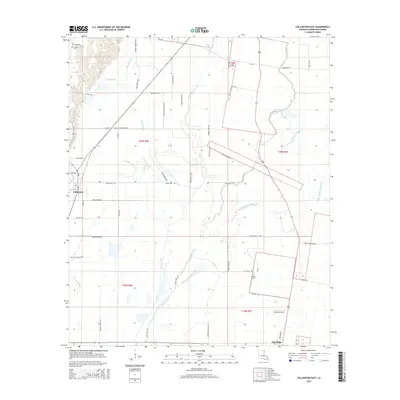
2015 Map of Collinston East
USGS Topo · Published 2015About this map
Little Bayou Bonne Idee and Bayou Galion snake through the flat agricultural lands of Morehouse Parish, defining a landscape of complex drainage systems and fertile bottomlands. These waterways, along with Cleora Brake and Patten Slough, illustrate the region's historical reliance on natural watercourses for land management and irrigation. The map focuses on the eastern reaches of Collinston and the community of Oak Ridge, areas where the grid of rural parish roads, such as Hog Walla Rd and Johnnie Jones Rd, connects long-standing family farms. Local history is anchored by landmarks like Cockrell Cem and Cooper Cem, while the inclusion of Barham Airport reflects the modernization of rural infrastructure in this section of the Louisiana Delta.
Find a feature on this map
54 named features on this map. Tap any name to fly to it.
Don’t see what you’re looking for? This feature index may not catch every label — zoom into the map to look around manually.
Map Details
Editions of this 2015 Collinston East Map
This is the sole edition of this map. No revisions or reprints were ever made.
Other maps of this area

1935 · Collinston
USGS Topo · 1:62,500

1935 · Naff
USGS Topo · 1:62,500

1935 · Hurricane
USGS Topo · 1:62,500

1935 · Bonita
USGS Topo · 1:62,500

1955 · Jackson
USGS Topo · 1:250,000

1956 · Bastrop
USGS Topo · 1:62,500

1957 · Collinston
USGS Topo · 1:62,500

1958 · Hurricane
USGS Topo · 1:62,500

1958 · Bonita
USGS Topo · 1:62,500

1961 · Jackson
USGS Topo · 1:250,000