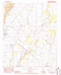
1982 Map of Collinston East
USGS Topo · Published 1983About this map
Oak Ridge and Collinston anchor this delta landscape during the early 1980s, revealing a rural environment defined by the slow movement of water and the precision of rail. The Missouri Pacific railroad cuts a straight diagonal across the terrain, passing through the Coulee State Wildlife Refuge and skirting various swampy lowlands like Cleora Brake and Patten Slough. This era shows a landscape heavily marked by small community hubs, particularly seen in the high density of rural churches including Jerusalem Ch, Olive Grove Ch, and True Vine Ch.
Find a feature on this map
28 named features on this map. Tap any name to fly to it.
Don’t see what you’re looking for? This feature index may not catch every label — zoom into the map to look around manually.
Map Details
Editions of this 1982 Collinston East Map
This is the sole edition of this map. No revisions or reprints were ever made.
Other maps of this area

1935 · Collinston
USGS Topo · 1:62,500

1935 · Naff
USGS Topo · 1:62,500

1935 · Hurricane
USGS Topo · 1:62,500

1935 · Bonita
USGS Topo · 1:62,500

1955 · Jackson
USGS Topo · 1:250,000

1956 · Bastrop
USGS Topo · 1:62,500

1957 · Collinston
USGS Topo · 1:62,500

1958 · Hurricane
USGS Topo · 1:62,500

1958 · Bonita
USGS Topo · 1:62,500

1961 · Jackson
USGS Topo · 1:250,000