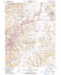
1991 Map of Collinsville
USGS Topo · Published 1991About this map
Collinsville and Troy anchor this 1991 landscape during a period of significant suburban expansion along the interstate corridors of southern Illinois. The transition from industrial roots to residential growth is evident in developments like Wilson Heights and Meadow Heights, yet the map remains densely populated with markers of its earlier agricultural and coal-mining character. Dozens of family and community burial grounds, such as Lemen Cem and Fehnel Cem, are scattered among the ridges.
Find a feature on this map
59 named features on this map. Tap any name to fly to it.
Don’t see what you’re looking for? This feature index may not catch every label — zoom into the map to look around manually.
Map Details
Editions of this 1991 Collinsville Map
This is the sole edition of this map. No revisions or reprints were ever made.
Other maps of this area

1888 · St. Louis
USGS Topo · 1:62,500

1907 · Belleville
USGS Topo · 1:62,500

1927 · Alton
USGS Topo · 1:62,500

1927 · Edwardsville
USGS Topo · 1:62,500

1931 · French Village
USGS Topo · 1:24,000

1932 · Edwardsville
USGS Topo · 1:62,500

1934 · Alton
USGS Topo · 1:62,500

1935 · Lebanon
USGS Topo · 1:24,000

1935 · French Village
USGS Topo · 1:24,000

1935 · Monks Mound
USGS Topo · 1:24,000