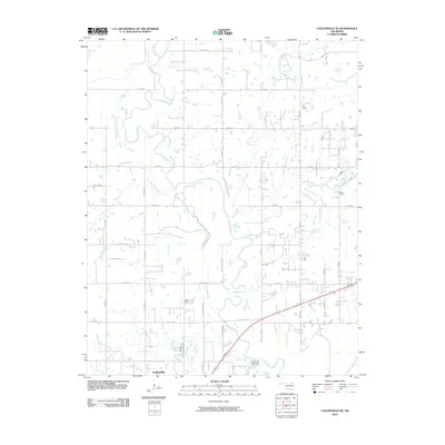
2010 Map of Collinsville NE
USGS Topo · Published 2010About this map
The Caney River meanders across this landscape, defining a complex drainage system that includes Saunders Creek, Rabb Creek, and Horsepen Creek. At the southern edge, the northern outskirts of Collinsville appear near the confluence of several smaller waterways like Cherry Creek and Blackjack Creek. This era of the late 2000s shows a transition between the established town center and the surrounding rural sections, where a tight grid of section-line roads such as W 3900 RD and N 145th East Ave coordinates the territory. A notable piece of local infrastructure is the Collinsville Lake Dam on East Creek, which regulates water flow just east of the main settlement. The map documents how the riparian corridors of Lacy Creek and Bevan Creek break up the agricultural blocks, creating a distinct pattern of natural winding paths against a modern, engineered road network.
Find a feature on this map
42 named features on this map. Tap any name to fly to it.
Don’t see what you’re looking for? This feature index may not catch every label — zoom into the map to look around manually.
Map Details
Editions of this 2010 Collinsville NE Map
This is the sole edition of this map. No revisions or reprints were ever made.
Other maps of this area

1901 · Claremore
USGS Topo · 1:125,000

1901 · Nowata
USGS Topo · 1:125,000

1914 · Nowata
USGS Topo · 1:125,000

1914 · Claremore
USGS Topo · 1:125,000

1916 · Claremore
USGS Topo · 1:125,000

1954 · Tulsa
USGS Topo · 1:250,000

1955 · Sperry
USGS Topo · 1:24,000

1956 · Collinsville
USGS Topo · 1:24,000

1958 · Tulsa
USGS Topo · 1:250,000

1959 · Collinsville NE
USGS Topo · 1:24,000