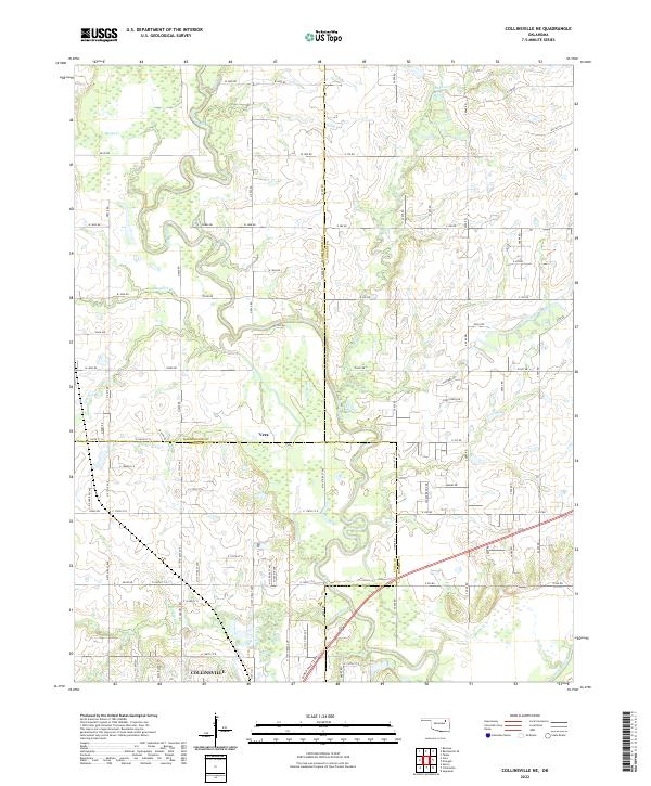
2022 Map of Collinsville NE
USGS Topo · Published 2022About this map
The Caney River winds through this northeastern Oklahoma landscape, marking a terrain defined by the convergence of Rogers, Tulsa, and Washington counties. The southern edge of the survey captures the outskirts of Collinsville, where the grid of the town begins to give way to the rural sections of the Cherokee Nation's historic territory. Further north, the settlement of Vera sits near the junction of several drainage systems, including Lacy Cr and Saunders Cr. The map reveals a highly structured rural section-line road network, such as W 3800 Rd and E 380 Rd, which provides access to the numerous creek valleys that feed into the river basin. Numerous smaller tributaries like Horsepen Cr and Rabb Cr underscore the well-watered nature of these ranching and agricultural lands at the turn of the 2020s.
Find a feature on this map
58 named features on this map. Tap any name to fly to it.
Don’t see what you’re looking for? This feature index may not catch every label — zoom into the map to look around manually.
Map Details
Editions of this 2022 Collinsville NE Map
This is the sole edition of this map. No revisions or reprints were ever made.
Other maps of this area

1901 · Claremore
USGS Topo · 1:125,000

1901 · Nowata
USGS Topo · 1:125,000

1914 · Nowata
USGS Topo · 1:125,000

1914 · Claremore
USGS Topo · 1:125,000

1916 · Claremore
USGS Topo · 1:125,000

1954 · Tulsa
USGS Topo · 1:250,000

1955 · Sperry
USGS Topo · 1:24,000

1956 · Collinsville
USGS Topo · 1:24,000

1958 · Tulsa
USGS Topo · 1:250,000

1959 · Collinsville NE
USGS Topo · 1:24,000