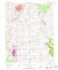
1956 Map of Collinsville
USGS Topo · Published 1991About this map
The Collinsville and Owasso communities represent the focal points of this mid-century Oklahoma landscape, positioned along the prominent line of the Atchison Topeka and Santa Fe railroad. The map documents an era of industrial transitions, featuring a large strip mine southwest of Collinsville and a claypit to the north, alongside the agricultural and residential growth of the TULSA METROPOLITAN AREA. Educational and civic foundations are visible through institutions like Central High Sch, Washington Sch, and City Hall.
Find a feature on this map
26 named features on this map. Tap any name to fly to it.
Don’t see what you’re looking for? This feature index may not catch every label — zoom into the map to look around manually.
Map Details
Editions of this 1956 Collinsville Map
3 editions found
Other maps of this area

1901 · Claremore
USGS Topo · 1:125,000

1914 · Claremore
USGS Topo · 1:125,000

1916 · Claremore
USGS Topo · 1:125,000

1954 · Tulsa
USGS Topo · 1:250,000

1954 · Tulsa
USGS Topo · 1:24,000

1955 · Sperry
USGS Topo · 1:24,000

1955 · Mingo
USGS Topo · 1:24,000

1956 · Collinsville
USGS Topo · 1:24,000

1958 · Tulsa
USGS Topo · 1:250,000

1959 · Collinsville NE
USGS Topo · 1:24,000