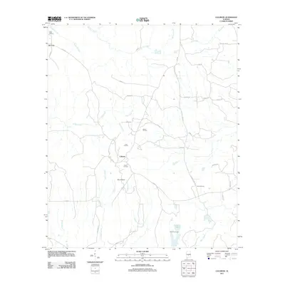
2011 Map of Collirene
USGS Topo · Published 2011About this map
Old Town and the settlement of Collirene anchor this rural landscape in central Alabama during the early twenty-first century. The map reveals a community defined by a high density of family and community burial grounds, including the Town Creek Cemetery, Dunklin Cemetery, Rives Cemetery, Mount Cemetery, and Shiloh Cemetery, which serve as vital markers for genealogical research in this portion of Dallas County. The terrain is deeply carved by a network of waterways like Old Town Creek, Mush Creek, and Sullivan Creek, which dictate the winding paths of local thoroughfares such as Collirene Dr and Co Hwy 12. To the south, J R Paul Lake and the J R Paul Lake Dam represent modern water management alongside the traditional agriculture-based layout of the region. The prominence of Mount Baber provides a distinct topographic landmark amidst the numerous branches and creeks that feed the Alabama River watershed.
Find a feature on this map
43 named features on this map. Tap any name to fly to it.
Don’t see what you’re looking for? This feature index may not catch every label — zoom into the map to look around manually.
Map Details
Editions of this 2011 Collirene Map
This is the sole edition of this map. No revisions or reprints were ever made.
Other maps of this area

1953 · Montgomery
USGS Topo · 1:250,000

1956 · Montgomery
USGS Topo · 1:250,000

1957 · Montgomery
USGS Topo · 1:250,000

1957 · Autaugaville
USGS Topo · 1:62,500

1957 · Benton
USGS Topo · 1:62,500

1957 · Braggs
USGS Topo · 1:62,500

1975 · Benton SE
USGS Topo · 1:24,000

1975 · Autaugaville SW
USGS Topo · 1:24,000
1975 · Benton SW
USGS Topo · 1:24,000
1981 · Gordonsville
USGS Topo · 1:24,000