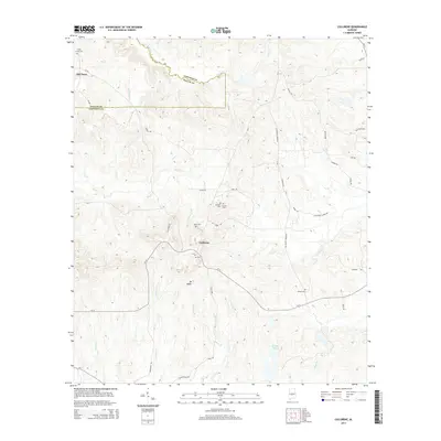
2014 Map of Collirene
USGS Topo · Published 2014About this map
Old Town and Colliirene sit within a landscape defined by the winding border between Dallas and Lowndes counties. This 2014 survey captures a rural Alabama territory where family names and community ties are preserved in the landscape through numerous small burial grounds. Features such as Town Creek Cem, Dunklin Cem, and Shiloh Cem are scattered across the terrain, indicating long-established local lineages. The topography is anchored by Mt Baber, while a network of creeks including Mush Cr, Town Creek, and Sullivan Cr drain the undulating hills. Local infrastructure is primarily composed of county roads like CR-12 and named routes like Old Town Rd and Major Ralph Rd, connecting isolated homesteads and community landmarks such as Mt Cem and Rives Cem.
Find a feature on this map
47 named features on this map. Tap any name to fly to it.
Don’t see what you’re looking for? This feature index may not catch every label — zoom into the map to look around manually.
Map Details
Editions of this 2014 Collirene Map
This is the sole edition of this map. No revisions or reprints were ever made.
Other maps of this area

1953 · Montgomery
USGS Topo · 1:250,000

1956 · Montgomery
USGS Topo · 1:250,000

1957 · Montgomery
USGS Topo · 1:250,000

1957 · Autaugaville
USGS Topo · 1:62,500

1957 · Benton
USGS Topo · 1:62,500

1957 · Braggs
USGS Topo · 1:62,500

1975 · Benton SE
USGS Topo · 1:24,000

1975 · Autaugaville SW
USGS Topo · 1:24,000
1975 · Benton SW
USGS Topo · 1:24,000
1981 · Gordonsville
USGS Topo · 1:24,000