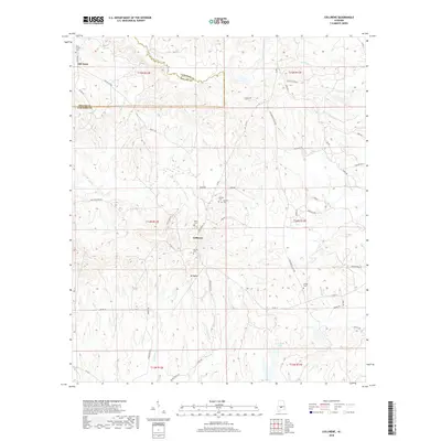
2018 Map of Collirene
USGS Topo · Published 2018About this map
Old Town and Collirene anchor this portion of the Black Belt region, where the landscape is defined by the winding paths of Old Town Cr and Mush Cr. The topography reveals a network of small creeks and branches, such as Church Br and Sullivan Cr, that drain the undulating terrain toward larger basins. A notable concentration of family and community burial sites, including Dunklin Cem, Rives Cem, and Shiloh Cem, suggests a long history of local settlement and genealogical significance. Centrally located, Mt Baber rises as a distinct landmark near the junction of Sam Wright Ln and Lyon Rd. The map detail shows how historic rural routes like Old Town Rd and the Collirene Cutoff Rd continue to connect these scattered agrarian communities. In the southern reach, J R Paul Lake and the headwaters of Green Br illustrate the area's ongoing reliance on local water sources for land management.
Find a feature on this map
59 named features on this map. Tap any name to fly to it.
Don’t see what you’re looking for? This feature index may not catch every label — zoom into the map to look around manually.
Map Details
Editions of this 2018 Collirene Map
This is the sole edition of this map. No revisions or reprints were ever made.
Other maps of this area

1953 · Montgomery
USGS Topo · 1:250,000

1956 · Montgomery
USGS Topo · 1:250,000

1957 · Montgomery
USGS Topo · 1:250,000

1957 · Autaugaville
USGS Topo · 1:62,500

1957 · Benton
USGS Topo · 1:62,500

1957 · Braggs
USGS Topo · 1:62,500

1975 · Benton SE
USGS Topo · 1:24,000

1975 · Autaugaville SW
USGS Topo · 1:24,000
1975 · Benton SW
USGS Topo · 1:24,000
1981 · Gordonsville
USGS Topo · 1:24,000