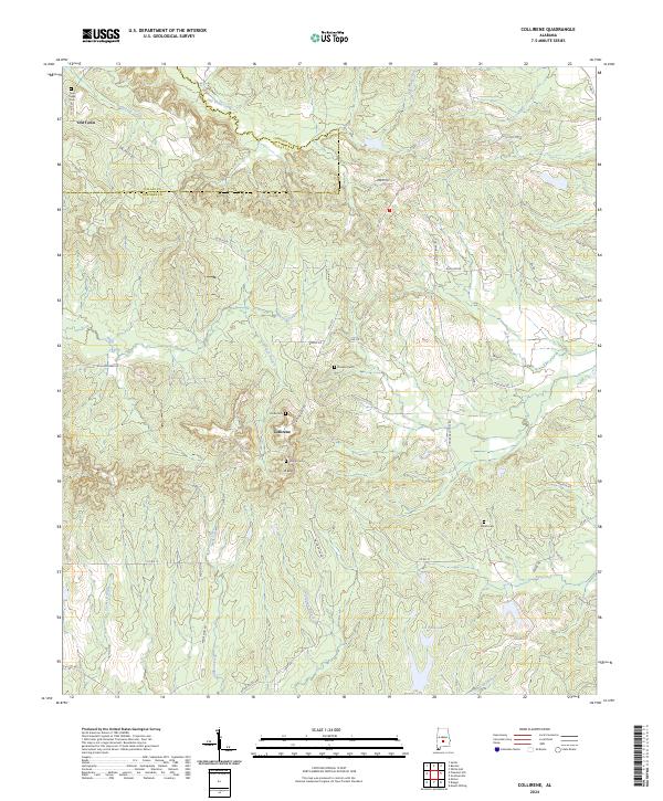
2024 Map of Collirene
USGS Topo · Published 2024About this map
Collirene serves as a central landmark in this portion of the Alabama Black Belt, situated along the border of Lowndes and Dallas counties. The landscape is defined by a dense network of watercourses, including Mush Creek and Soapstone Creek, which have shaped the settlement patterns of this agrarian region. This 2024 data reveals a significant concentration of local family history through its numerous burial grounds, such as Rivés Cem, Dunklin Cem, and Shiloh Cem, which are scattered among the ridges and creek bottoms.
Find a feature on this map
55 named features on this map. Tap any name to fly to it.
Don’t see what you’re looking for? This feature index may not catch every label — zoom into the map to look around manually.
Map Details
Editions of this 2024 Collirene Map
This is the sole edition of this map. No revisions or reprints were ever made.
Other maps of this area

1953 · Montgomery
USGS Topo · 1:250,000

1956 · Montgomery
USGS Topo · 1:250,000

1957 · Montgomery
USGS Topo · 1:250,000

1957 · Autaugaville
USGS Topo · 1:62,500

1957 · Benton
USGS Topo · 1:62,500

1957 · Braggs
USGS Topo · 1:62,500

1975 · Benton SE
USGS Topo · 1:24,000

1975 · Autaugaville SW
USGS Topo · 1:24,000
1975 · Benton SW
USGS Topo · 1:24,000
1981 · Gordonsville
USGS Topo · 1:24,000