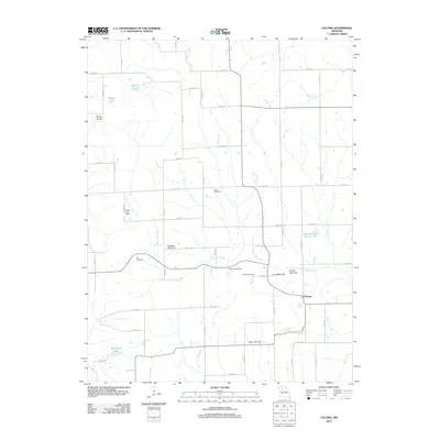
2012 Map of Coloma
USGS Topo · Published 2012About this map
The settlement of Coloma serves as the focal point of this Carroll County landscape, situated amidst a network of rural county roads and agricultural terrain. Notable landmarks for genealogical research include the Salem Cemetery, Hill Cemetery, and Braden Cemetery, which are scattered across the township. The area is defined by its water management and natural drainage, with Tater Hill Creek winding through the center, feeding into several controlled reservoirs such as Susewine Lake Dam, Henry Lake Dam, and Harts Lake Dam.
Find a feature on this map
53 named features on this map. Tap any name to fly to it.
Don’t see what you’re looking for? This feature index may not catch every label — zoom into the map to look around manually.
Map Details
Editions of this 2012 Coloma Map
This is the sole edition of this map. No revisions or reprints were ever made.
Other maps of this area

1889 · Lexington
USGS Topo · 1:125,000

1890 · Marshall
USGS Topo · 1:125,000

1892 · Marshall
USGS Topo · 1:125,000

1901 · Marshall
USGS Topo · 1:125,000

1924 · Dawn
USGS Topo · 1:62,500

1924 · Hale
USGS Topo · 1:62,500

1950 · Coloma
USGS Topo · 1:24,000

1950 · Plymouth
USGS Topo · 1:24,000

1951 · Utica
USGS Topo · 1:62,500

1951 · Hale
USGS Topo · 1:62,500