
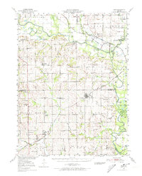
1951 Map of Hale
USGS Topo · Published 1952About this map
Hale stands as a central hub in this post-war survey of the Grand River basin, where the Livingston and Carroll County lines meet. The landscape is defined by the meandering courses of the Grand River and Medicine Creek, which feed into the extensive Fountain Grove Wildlife Management Area. This mid-century record captures a rural Missouri society in transition, noting numerous schools that had already ceased operation, such as Asper Sch and Cor Campbell Sch. Local commerce and transit are anchored by the Wabash Railroad and the Chicago Burlington and Quincy Railroad, while the terrain rises toward the prominent Stokes Mound to the southwest. Genealogists will find a dense network of family-named landmarks and cemeteries, including the Arkadelphia Cem and Winfrey Cem, alongside small rural institutions like the Grace Church and Leaton Sch.
Find a feature on this map
81 named features on this map. Tap any name to fly to it.
Don’t see what you’re looking for? This feature index may not catch every label — zoom into the map to look around manually.
Map Details
Editions of this 1951 Hale Map
3 editions found
Other maps of this area

1889 · Lexington
USGS Topo · 1:125,000

1890 · Marshall
USGS Topo · 1:125,000

1892 · Marshall
USGS Topo · 1:125,000

1901 · Marshall
USGS Topo · 1:125,000

1921 · Chillicothe
USGS Topo · 1:62,500

1923 · Chillicothe
USGS Topo · 1:62,500

1924 · Dawn
USGS Topo · 1:62,500

1924 · Chula
USGS Topo · 1:62,500

1924 · Hale
USGS Topo · 1:62,500

1946 · Brookfield
USGS Topo · 1:62,500