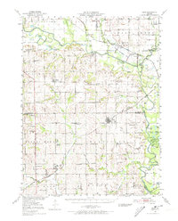
1951 Map of Hale
USGS Topo · Published 1973About this map
The Grand River and Chariton River define this fertile pocket of North Central Missouri, where the early 1950s landscape remains densely populated with the rural landmarks of an earlier agricultural era. The survey captures a high concentration of country schools, including many already marked as inactive, such as Asper Sch and West Sch. The central settlement of Hale serves as a local hub, while smaller outposts like Avalon and Tina anchor the surrounding townships. To the north, the Fountain Grove Wildlife Management Area occupies the bottomlands where the Wabash RR crosses the river plains.
Find a feature on this map
103 named features on this map. Tap any name to fly to it.
Don’t see what you’re looking for? This feature index may not catch every label — zoom into the map to look around manually.
Map Details
Editions of this 1951 Hale Map
3 editions found

Other maps of this area

1889 · Lexington
USGS Topo · 1:125,000

1890 · Marshall
USGS Topo · 1:125,000

1892 · Marshall
USGS Topo · 1:125,000

1901 · Marshall
USGS Topo · 1:125,000

1921 · Chillicothe
USGS Topo · 1:62,500

1923 · Chillicothe
USGS Topo · 1:62,500

1924 · Dawn
USGS Topo · 1:62,500

1924 · Chula
USGS Topo · 1:62,500

1924 · Hale
USGS Topo · 1:62,500

1946 · Brookfield
USGS Topo · 1:62,500