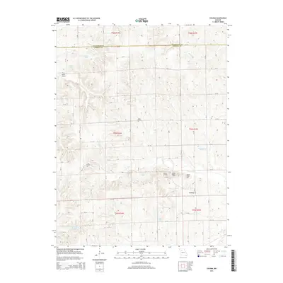
2015 Map of Coloma
USGS Topo · Published 2015About this map
Coloma serves as the central hub of this Missouri landscape, which straddles the boundary between Livingston Co and Carroll Co. The terrain is defined by its numerous small water bodies and unique landforms, including the distinct heights of Long Tater Hill and Round Tater Hill located northwest of the main settlement. A dense network of county roads, such as CR 110 and CR 150, connects the agricultural parcels and provides access to several legacy sites. Local genealogy is well-represented by long-standing burial grounds like Salem Cemetery, Hill Cemetery, and Braden Cemetery. Numerous small lakes, including Sunshine Lake, Waitman Lake Section 30, and Harts Lake, are scattered across the drainage basins of Tater Hill Cr and Big Cr, reflecting a landscape managed for local irrigation and drainage in the northern Missouri plains.
Find a feature on this map
45 named features on this map. Tap any name to fly to it.
Don’t see what you’re looking for? This feature index may not catch every label — zoom into the map to look around manually.
Map Details
Editions of this 2015 Coloma Map
This is the sole edition of this map. No revisions or reprints were ever made.
Other maps of this area

1889 · Lexington
USGS Topo · 1:125,000

1890 · Marshall
USGS Topo · 1:125,000

1892 · Marshall
USGS Topo · 1:125,000

1901 · Marshall
USGS Topo · 1:125,000

1924 · Dawn
USGS Topo · 1:62,500

1924 · Hale
USGS Topo · 1:62,500

1950 · Coloma
USGS Topo · 1:24,000

1950 · Plymouth
USGS Topo · 1:24,000

1951 · Utica
USGS Topo · 1:62,500

1951 · Hale
USGS Topo · 1:62,500