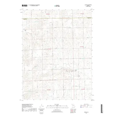
2017 Map of Coloma
USGS Topo · Published 2017About this map
The settlement of Coloma serves as the focal point for this rural landscape along the border of Livingston and Carroll counties. The terrain is characterized by a series of distinct elevations, most notably the cluster of Tater Hill, Long Tater Hill, and Round Tater Hill located just west of the village. These landforms rise above the surrounding drainage basins of Tater Hill Cr and Big Cr, illustrating the dissected topography typical of this Missouri region. For genealogists and local historians, several burial grounds are preserved across the sections, including Salem Cem, Hill Cem, and Braden Cem. The map reveals a high density of rural roads like State Hwy Z and State Hwy C that connect various family-named water bodies, such as Maberry Lake, Sykes Lake, and Mandeville Lake. This network of country roads and small creek valleys reflects a long-established agricultural pattern where farmsteads are tucked between timbered hollows and upland ridges.
Find a feature on this map
54 named features on this map. Tap any name to fly to it.
Don’t see what you’re looking for? This feature index may not catch every label — zoom into the map to look around manually.
Map Details
Editions of this 2017 Coloma Map
This is the sole edition of this map. No revisions or reprints were ever made.
Other maps of this area

1889 · Lexington
USGS Topo · 1:125,000

1890 · Marshall
USGS Topo · 1:125,000

1892 · Marshall
USGS Topo · 1:125,000

1901 · Marshall
USGS Topo · 1:125,000

1924 · Dawn
USGS Topo · 1:62,500

1924 · Hale
USGS Topo · 1:62,500

1950 · Coloma
USGS Topo · 1:24,000

1950 · Plymouth
USGS Topo · 1:24,000

1951 · Utica
USGS Topo · 1:62,500

1951 · Hale
USGS Topo · 1:62,500