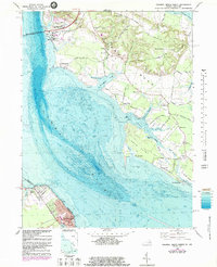
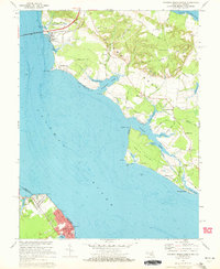
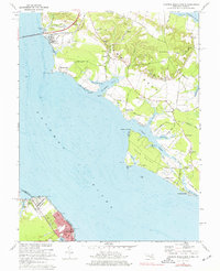
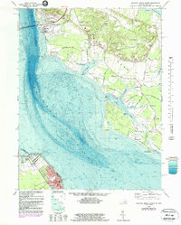
1968 Map of Colonial Beach North
USGS Topo · Published 1983About this map
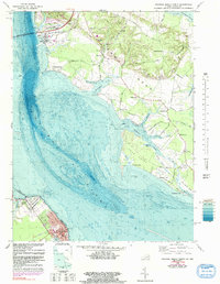
The Potomac River dominates this coastal landscape, serving as the border between Charles Co, Maryland, and Westmoreland Co, Virginia. The 1968 topography, updated with 1982 bathymetry, illustrates the intricate shoreline of Swan Point Neck and Wicomico Neck, where tidal inlets like Cuckold Creek and Piccowaxen Creek carve into the agricultural Maryland side. Transportation is anchored by the Harry W Nice Memorial Bridge, which connects the Virginia shore near Potomac Beach to the industrial and aviation activities at Aqua-Land Clifton Skypark.
Find a feature on this map
76 named features on this map. Tap any name to fly to it.
Don’t see what you’re looking for? This feature index may not catch every label — zoom into the map to look around manually.
Map Details
Editions of this 1968 Colonial Beach North Map
5 editions found
Other maps of this area

1889 · Fredericksburg
USGS Topo · 1:125,000

1892 · Fredericksburg
USGS Topo · 1:125,000

1892 · Montross
USGS Topo · 1:62,500

1894 · Wicomico
USGS Topo · 1:62,500

1894 · Fredericksburg
USGS Topo · 1:125,000

1895 · Wicomico
USGS Topo · 1:62,500

1895 · Nomini
USGS Topo · 1:125,000

1895 · Montross
USGS Topo · 1:62,500

1898 · Nomini
USGS Topo · 1:125,000

1902 · Wicomico
USGS Topo · 1:62,500