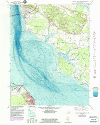
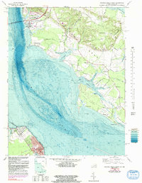
1968 Map of Colonial Beach North
USGS Topo · Published 1987About this map
Colonial Beach and Potomac Beach anchor the southern reaches of this riverfront survey, where the Potomac River forms the border between Virginia and Maryland. The landscape is defined by the broad waters of the Potomac and Wicomico River, separated by the peninsula of Swan Point Neck. Inland from the riverbanks, small rural communities like Wayside, Harris Lot, and Tompkinsville are connected by a network of local roads such as Morgantown Road and Banks O'Dee Road.
Find a feature on this map
73 named features on this map. Tap any name to fly to it.
Don’t see what you’re looking for? This feature index may not catch every label — zoom into the map to look around manually.
Map Details
Editions of this 1968 Colonial Beach North Map
5 editions found
Other maps of this area

1889 · Fredericksburg
USGS Topo · 1:125,000

1892 · Fredericksburg
USGS Topo · 1:125,000

1892 · Montross
USGS Topo · 1:62,500

1894 · Wicomico
USGS Topo · 1:62,500

1894 · Fredericksburg
USGS Topo · 1:125,000

1895 · Wicomico
USGS Topo · 1:62,500

1895 · Nomini
USGS Topo · 1:125,000

1895 · Montross
USGS Topo · 1:62,500

1898 · Nomini
USGS Topo · 1:125,000

1902 · Wicomico
USGS Topo · 1:62,500