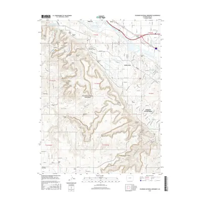
2016 Map of Colorado National Monument
USGS Topo · Published 2016About this map
Independence Monument stands as a central pillar within the Colorado National Monument, where the high desert plateau is carved by deep drainages like Wedding Canyon and Ute Canyon. This 2016 survey captures the complex intersection of the protected natural landscape and the sprawling urban boundaries of Grand Junction and Fruita. The engineered water systems of the Grand Valley are clearly visible, including the Redlands First Lift Canal and the Independent Reclamation Ditch, which redirect water from the Colorado River to support the region’s orchards and agriculture. Along the southern periphery, the high-altitude community of Glade Park appears with its local landmarks like the Glade Park Cem and Pinyon Airport. Winding through the monoliths, the iconic Rim Rock Drive provides access to geological features such as the Coke Ovens and the Squaw Fingers.
Find a feature on this map
145 named features on this map. Tap any name to fly to it.
Don’t see what you’re looking for? This feature index may not catch every label — zoom into the map to look around manually.
Map Details
Editions of this 2016 Colorado National Monument Map
This is the sole edition of this map. No revisions or reprints were ever made.
Other maps of this area

1934 · Colorado National Monument
USGS Topo · 1:24,000

1956 · Moab
USGS Topo · 1:250,000

1956 · Grand Junction
USGS Topo · 1:250,000

1959 · Grand Junction
USGS Topo · 1:250,000

1959 · Moab
USGS Topo · 1:250,000

1960 · Moab
USGS Topo · 1:250,000

1960 · Grand Junction
USGS Topo · 1:250,000

1962 · Moab
USGS Topo · 1:250,000

1962 · Grand Junction
USGS Topo · 1:250,000

1962 · Fruita
USGS Topo · 1:24,000