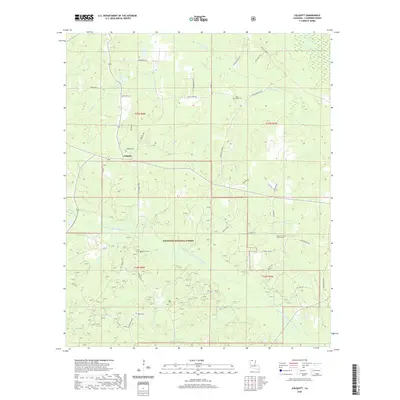
2020 Map of Colquitt
USGS Topo · Published 2020About this map
Colquitt serves as the focal point of this North Louisiana survey, situated where the Middle Fork Bayou D'Arbonne and several tributary creeks like Doe Br and Tiger Cr carve through the landscape. The territory is heavily shaped by the presence of the Kisatchie National Forest, which blankets much of the southern and central sections with a network of forest service roads including Fo RD 912 and Fire Dist Rd 910.
Find a feature on this map
48 named features on this map. Tap any name to fly to it.
Don’t see what you’re looking for? This feature index may not catch every label — zoom into the map to look around manually.
Map Details
Editions of this 2020 Colquitt Map
This is the sole edition of this map. No revisions or reprints were ever made.
Other maps of this area

1951 · Summerfield
USGS Topo · 1:62,500

1952 · Homer
USGS Topo · 1:62,500

1953 · El Dorado
USGS Topo · 1:250,000

1955 · Shreveport
USGS Topo · 1:250,000

1956 · Shreveport
USGS Topo · 1:250,000

1957 · El Dorado
USGS Topo · 1:250,000

1958 · El Dorado
USGS Topo · 1:250,000

1960 · El Dorado
USGS Topo · 1:250,000
1971 · Wesson
USGS Topo · 1:24,000
1971 · Emerson SE
USGS Topo · 1:24,000