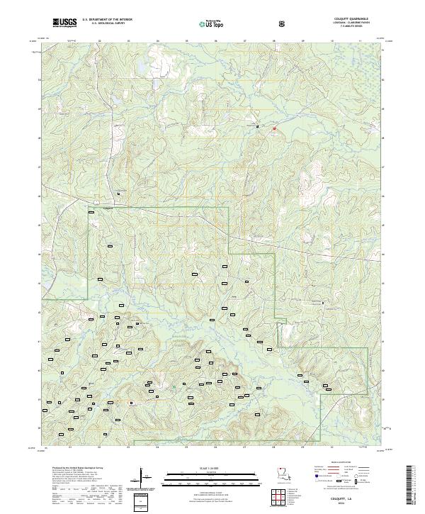
2024 Map of Colquitt
USGS Topo · Published 2024About this map
Colquitt serves as the central settlement point in this Claiborne Parish landscape, where the rural character is defined by the winding course of Lick Creek. The mapping reveals a land shaped by forestry and agricultural divisions, characteristic of the North Louisiana uplands. With the area largely integrated into the Kisatchie National Forest, the map provides a look at the modern forest road networks and traditional property lines that have persisted since the era of original land patents. The drainage patterns of Lick Creek and its smaller tributaries illustrate the natural geography that influenced early homesteading and later federal forest management in this corner of the state.
Find a feature on this map
2 named features on this map. Tap any name to fly to it.
Don’t see what you’re looking for? This feature index may not catch every label — zoom into the map to look around manually.
Map Details
Editions of this 2024 Colquitt Map
This is the sole edition of this map. No revisions or reprints were ever made.
Other maps of this area

1951 · Summerfield
USGS Topo · 1:62,500

1952 · Homer
USGS Topo · 1:62,500

1953 · El Dorado
USGS Topo · 1:250,000

1955 · Shreveport
USGS Topo · 1:250,000

1956 · Shreveport
USGS Topo · 1:250,000

1957 · El Dorado
USGS Topo · 1:250,000

1958 · El Dorado
USGS Topo · 1:250,000

1960 · El Dorado
USGS Topo · 1:250,000
1971 · Wesson
USGS Topo · 1:24,000
1971 · Emerson SE
USGS Topo · 1:24,000