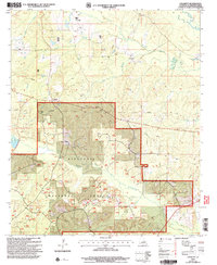
2003 Map of Colquitt
USGS Topo · Published 2005About this map
Colquitt serves as the primary settlement center in this portion of Claiborne Parish, situated just north of the expansive Kisatchie National Forest boundary. The landscape is defined by a dense network of watercourses, most notably the meandering Middle Fork Bayou D'Arbonne and Corney Bayou, which drain the timbered uplands. This 2003 revision, based on 1980s topography and late-90s imagery, captures a rural Louisiana environment where resource management and infrastructure coincide. A prominent pipeline corridor cuts across the terrain, reflecting the industrial footprint within the forest lands. Genealogists may find interest in the scattered Cem locations and family-named water features like Doe Branch and Tanner Creek, while the presence of a Pump Sta near the main settlement highlights the local utility infrastructure serving this corner of the parish.
Find a feature on this map
12 named features on this map. Tap any name to fly to it.
Don’t see what you’re looking for? This feature index may not catch every label — zoom into the map to look around manually.
Map Details
Editions of this 2003 Colquitt Map
This is the sole edition of this map. No revisions or reprints were ever made.
Other maps of this area

1951 · Summerfield
USGS Topo · 1:62,500

1952 · Homer
USGS Topo · 1:62,500

1953 · El Dorado
USGS Topo · 1:250,000

1955 · Shreveport
USGS Topo · 1:250,000

1956 · Shreveport
USGS Topo · 1:250,000

1957 · El Dorado
USGS Topo · 1:250,000

1958 · El Dorado
USGS Topo · 1:250,000

1960 · El Dorado
USGS Topo · 1:250,000
1971 · Wesson
USGS Topo · 1:24,000
1971 · Emerson SE
USGS Topo · 1:24,000