
1962 Map of Colton SE
USGS Topo · Published 1963About this map
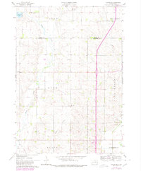
Skunk Creek and its tributary, Willow Creek, define the drainage of this agricultural landscape along the border of Moody and Minnehaha counties during the early 1960s. The map illustrates a rural society organized by townships, including Lynn, Enterprise, Burk, and Sverdrup, where the pattern of section-line roads and scattered farmsteads remains the dominant footprint. A notable feature of the local transport history is the Old Railroad Grade in the southwestern corner, reflecting a period of rail expansion that had already transitioned to other uses by this time.
Find a feature on this map
15 named features on this map. Tap any name to fly to it.
Don’t see what you’re looking for? This feature index may not catch every label — zoom into the map to look around manually.
Map Details
Editions of this 1962 Colton SE Map
2 editions found
Other maps of this area

1955 · Sioux Falls
USGS Topo · 1:250,000

1958 · Sioux Falls
USGS Topo · 1:250,000

1962 · Dell Rapids
USGS Topo · 1:24,000

1962 · Renner
USGS Topo · 1:24,000

1962 · Hartford North
USGS Topo · 1:24,000

1962 · Crooks
USGS Topo · 1:24,000

1963 · Trent
USGS Topo · 1:24,000

1963 · Colman
USGS Topo · 1:24,000

1968 · Wentworth
USGS Topo · 1:24,000
1968 · Colton
USGS Topo · 1:24,000