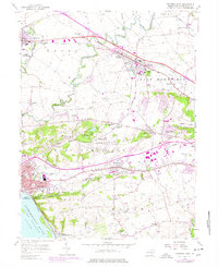
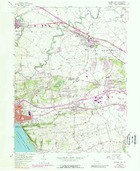
1956 Map of Columbia East
USGS Topo · Published 1977About this map
Columbia and the industrial riverfront of Lake Clarke define the southwestern edge of this survey, where the Conrail line parallels the Susquehanna River. Moving inland, the landscape transitions from the steep elevations of Chestnut Hill and Manor Hills into the fertile agricultural basins of Rapho and East Hempfield townships. This 1950s record, with later revisions, documents the expansion of suburban corridors along Harrisburg Pike and the growth of established centers like Mountville and Landisville.
Find a feature on this map
71 named features on this map. Tap any name to fly to it.
Don’t see what you’re looking for? This feature index may not catch every label — zoom into the map to look around manually.
Map Details
Editions of this 1956 Columbia East Map
5 editions found
Other maps of this area

1902 · Lancaster
USGS Topo · 1:62,500

1904 · Lancaster
USGS Topo · 1:62,500

1908 · Middletown
USGS Topo · 1:62,500

1908 · York
USGS Topo · 1:62,500

1910 · York
USGS Topo · 1:62,500

1912 · Mc Calls Ferry
USGS Topo · 1:62,500

1943 · Lancaster
USGS Topo · 1:62,500

1943 · Middletown
USGS Topo · 1:62,500

1943 · Mc Calls Ferry
USGS Topo · 1:62,500

1948 · Baltimore
USGS Topo · 1:250,000