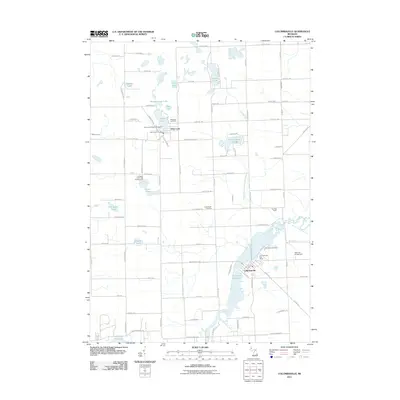
2011 Map of Columbiaville
USGS Topo · Published 2011About this map
The village of Columbiaville sits at the edge of the Holloway Reservoir, where the Flint River is joined by the South Fork Flint River. This portion of Lapeer and Genesee counties is defined by a dense network of kettle lakes and managed drainage systems like the Hemmingway and Whipple Drain. To the north, the settlement of Otter Lake serves as a local hub, anchored by the Otter Lake Post Office and nearby recreational spaces such as the Otter Lake Village Campground.
Find a feature on this map
69 named features on this map. Tap any name to fly to it.
Don’t see what you’re looking for? This feature index may not catch every label — zoom into the map to look around manually.
Map Details
Editions of this 2011 Columbiaville Map
This is the sole edition of this map. No revisions or reprints were ever made.
Other maps of this area

1920 · Flint
USGS Topo · 1:62,500

1922 · Flint
USGS Topo · 1:62,500

1943 · Flint
USGS Topo · 1:62,500

1954 · Flint
USGS Topo · 1:250,000

1958 · Flint
USGS Topo · 1:250,000

1963 · Mayville
USGS Topo · 1:24,000

1963 · Columbiaville
USGS Topo · 1:24,000

1963 · Elba
USGS Topo · 1:24,000

1963 · Vassar
USGS Topo · 1:24,000

1963 · Juniata
USGS Topo · 1:24,000