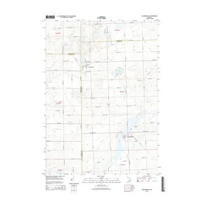
2014 Map of Columbiaville
USGS Topo · Published 2014About this map
The Flint River winds through this section of Lapeer County, anchoring the village of Columbiaville and flowing south toward the expansive Holloway Reservoir. This landscape is defined by its complex glacial hydrology, evidenced by numerous named kettles and drains such as Hemmingway Lake, Gawdy Lake, and the Forest Drain. Near the northern border, the settlement of Otter Lake straddles the line between Lapeer and Genesee counties, serving as a secondary local hub. For those tracing family histories or land use, the map clearly identifies several rural burial grounds, including Woodlawn Cem and Hollenbeck Cem, while the intricate network of local roads like Marathon Rd and Otter Lake Rd connects these scattered communities and water bodies across the Lapeer, Genesee, and Tuscola county intersections.
Find a feature on this map
92 named features on this map. Tap any name to fly to it.
Don’t see what you’re looking for? This feature index may not catch every label — zoom into the map to look around manually.
Map Details
Editions of this 2014 Columbiaville Map
This is the sole edition of this map. No revisions or reprints were ever made.
Other maps of this area

1920 · Flint
USGS Topo · 1:62,500

1922 · Flint
USGS Topo · 1:62,500

1943 · Flint
USGS Topo · 1:62,500

1954 · Flint
USGS Topo · 1:250,000

1958 · Flint
USGS Topo · 1:250,000

1963 · Mayville
USGS Topo · 1:24,000

1963 · Columbiaville
USGS Topo · 1:24,000

1963 · Elba
USGS Topo · 1:24,000

1963 · Vassar
USGS Topo · 1:24,000

1963 · Juniata
USGS Topo · 1:24,000