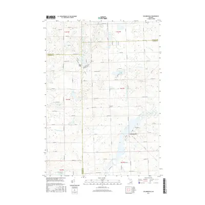
2017 Map of Columbiaville
USGS Topo · Published 2017About this map
The Flint River valley defines this Lapeer County landscape, where the waters of the Holloway Reservoir meet the village of Columbiaville. This area is characterized by an intricate network of glacial lakes and managed drains, such as Hemingway Lake and Lake Henson, which supported the early agricultural and settlement patterns of Marathon Township. The map documents the rural infrastructure connecting the village to the neighboring community of Otter Lake, located at the tri-county junction of Lapeer, Genesee, and Tuscola. Local history and genealogy are preserved through the locations of the Woodlawn Cem, Hollenbeck Cem, and Otter Lake Cem, while the extensive drainage system, including the Hemingway and Whipple Drain, illustrates the long-term modification of the marshy terrain for human habitation.
Find a feature on this map
107 named features on this map. Tap any name to fly to it.
Don’t see what you’re looking for? This feature index may not catch every label — zoom into the map to look around manually.
Map Details
Editions of this 2017 Columbiaville Map
This is the sole edition of this map. No revisions or reprints were ever made.
Other maps of this area

1920 · Flint
USGS Topo · 1:62,500

1922 · Flint
USGS Topo · 1:62,500

1943 · Flint
USGS Topo · 1:62,500

1954 · Flint
USGS Topo · 1:250,000

1958 · Flint
USGS Topo · 1:250,000

1963 · Mayville
USGS Topo · 1:24,000

1963 · Columbiaville
USGS Topo · 1:24,000

1963 · Elba
USGS Topo · 1:24,000

1963 · Vassar
USGS Topo · 1:24,000

1963 · Juniata
USGS Topo · 1:24,000