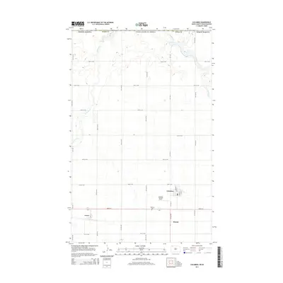
2014 Map of Columbus
USGS Topo · Published 2014About this map
Columbus serves as the primary hub in this portion of Burke County, North Dakota, situated just south of the international boundary between the United States and Canada. The landscape is defined by the prairie potholes and drainage patterns of the West Branch Short Creek and East Branch Short Creek. These waterways wind through a strictly organized grid of agricultural roads, including the east-west corridors of 107th St NW and 104th St NW. To the south and west of the main town, smaller settlements like Larson and Kincaid are visible, reflecting the dispersed rural development typical of the High Plains. Essential local infrastructure, such as the Columbus Municipal Airport and the Columbus Cemetery, anchor the community's geographic footprint within this vast, sectioned terrain.
Find a feature on this map
23 named features on this map. Tap any name to fly to it.
Don’t see what you’re looking for? This feature index may not catch every label — zoom into the map to look around manually.
Map Details
Editions of this 2014 Columbus Map
This is the sole edition of this map. No revisions or reprints were ever made.
Other maps of this area

1947 · Columbus
USGS Topo · 1:24,000

1948 · Beaver Lake
USGS Topo · 1:24,000

1948 · Stampede
USGS Topo · 1:24,000

1949 · Columbus SW
USGS Topo · 1:24,000

1949 · Atcoal
USGS Topo · 1:24,000

1949 · Columbus
USGS Topo · 1:24,000

1949 · Columbus SE
USGS Topo · 1:24,000

1950 · Columbus
USGS Topo · 1:62,500

1950 · Portal
USGS Topo · 1:62,500

1953 · Williston
USGS Topo · 1:250,000