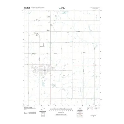
2010 Map of Columbus
USGS Topo · Published 2010About this map
Columbus serves as the focal point of this Cherokee County survey, revealing a well-defined grid of residential and commercial streets situated at the intersection of several major regional routes. The map documents the city's civic infrastructure, notably the Cherokee County Fairgrounds on the southern edge and a cluster of burial grounds including Park Cemetery and Columbus Cemetery. Surrounding the city, the landscape is defined by the drainages of Brush Creek and Little Cherry Creek, where smaller rural settlements like Stippville, Turck, and Skidmore are positioned along the primary north-south corridors.
Find a feature on this map
46 named features on this map. Tap any name to fly to it.
Don’t see what you’re looking for? This feature index may not catch every label — zoom into the map to look around manually.
Map Details
Editions of this 2010 Columbus Map
This is the sole edition of this map. No revisions or reprints were ever made.
Other maps of this area

1886 · Joplin
USGS Topo · 1:125,000

1894 · Joplin
USGS Topo · 1:125,000

1918 · Columbus
USGS Topo · 1:62,500

1943 · Cherokee
USGS Topo · 1:62,500

1945 · Pittsburg
USGS Topo · 1:62,500

1945 · Cherokee
USGS Topo · 1:62,500

1947 · Joplin
USGS Topo · 1:250,000

1947 · Pittsburg
USGS Topo · 1:62,500

1949 · Joplin
USGS Topo · 1:250,000

1950 · Pittsburg
USGS Topo · 1:62,500