
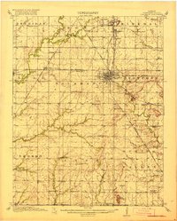
1918 Map of Columbus
USGS Topo · Published 1918About this map
Columbus serves as the bustling hub of Cherokee County during the late 1910s, defined by a dense intersection of major rail lines including the St. Louis San Francisco RR and the Missouri Kansas and Texas. The landscape is dotted with a high density of rural schoolhouses, such as Rising Sun School and Lone Elm School, indicating a well-populated agricultural and industrial hinterland. To the north, mining and processing are suggested by the proximity of Cokedale, Fleming, and Stippville.
Find a feature on this map
76 named features on this map. Tap any name to fly to it.
Don’t see what you’re looking for? This feature index may not catch every label — zoom into the map to look around manually.
Map Details
Editions of this 1918 Columbus Map
2 editions found
Other maps of this area

1886 · Joplin
USGS Topo · 1:125,000

1886 · Parsons
USGS Topo · 1:125,000

1893 · Parsons
USGS Topo · 1:125,000

1894 · Joplin
USGS Topo · 1:125,000

1901 · Vinita
USGS Topo · 1:125,000

1907 · Wyandotte
USGS Topo · 1:125,000

1909 · Wyandotte
USGS Topo · 1:125,000

1913 · Vinita
USGS Topo · 1:125,000

1943 · McCune
USGS Topo · 1:62,500

1943 · Cherokee
USGS Topo · 1:62,500