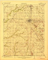
1918 Map of Columbus
USGS Topo · Published 1918About this map
Columbus serves as the focal point of this 1916 survey, a bustling rail hub where the Missouri Pacific, St. Louis San Francisco, and Missouri Kansas and Texas railroads converge. This transit network supported a landscape dotted with coal-mining settlements and dozens of small school districts, many named for local landmarks like the Lone Elm School or Center Star School. The terrain is defined by the headwaters of Fly Creek and Willow Creek, which wind through townships like Salamanca and Spring Valley.
Find a feature on this map
76 named features on this map. Tap any name to fly to it.
Don’t see what you’re looking for? This feature index may not catch every label — zoom into the map to look around manually.
Map Details
Editions of this 1918 Columbus Map
2 editions found
Other maps of this area

1886 · Joplin
USGS Topo · 1:125,000

1886 · Parsons
USGS Topo · 1:125,000

1893 · Parsons
USGS Topo · 1:125,000

1894 · Joplin
USGS Topo · 1:125,000

1901 · Vinita
USGS Topo · 1:125,000

1907 · Wyandotte
USGS Topo · 1:125,000

1909 · Wyandotte
USGS Topo · 1:125,000

1913 · Vinita
USGS Topo · 1:125,000

1918 · Columbus
USGS Topo · 1:62,500

1943 · McCune
USGS Topo · 1:62,500