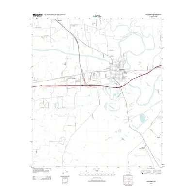
2013 Map of Columbus
USGS Topo · Published 2013About this map
Columbus serves as the central hub of this 2013 landscape, where the winding path of the Colorado River creates a distinct loop around the town. The presence of the Colorado County Courthouse Historic District anchors the historic core, while industrial and aviation footprints like the Columbus Oil Field and the River Field Airport indicate the modern economic drivers of the region. Local heritage is preserved in the rural surroundings through sites such as the Brune Cem and Gay Hill Cem, providing valuable points of interest for genealogists.
Find a feature on this map
96 named features on this map. Tap any name to fly to it.
Don’t see what you’re looking for? This feature index may not catch every label — zoom into the map to look around manually.
Map Details
Editions of this 2013 Columbus Map
This is the sole edition of this map. No revisions or reprints were ever made.
Other maps of this area

1919 · Fayettsville
USGS Topo · 1:62,500

1953 · Seguin
USGS Topo · 1:250,000

1956 · Bellville
USGS Topo · 1:62,500

1956 · Glidden
USGS Topo · 1:62,500

1957 · Eagle Lake
USGS Topo · 1:62,500

1957 · Ellinger
USGS Topo · 1:24,000

1957 · Altair
USGS Topo · 1:24,000

1957 · Columbus
USGS Topo · 1:24,000

1957 · Borden
USGS Topo · 1:24,000

1958 · Seguin
USGS Topo · 1:250,000