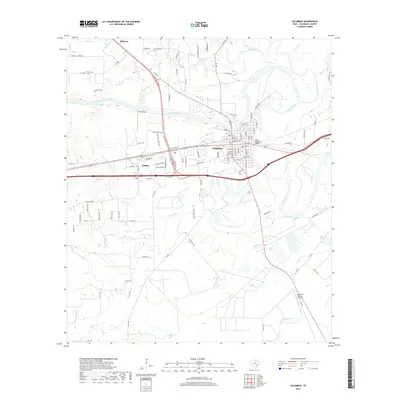
2019 Map of Columbus
USGS Topo · Published 2019About this map
The Colorado River makes a dramatic horseshoe bend around the town of Columbus, anchoring the geography of this central Texas landscape. As the county seat of Colorado County, the settlement is a hub of regional transportation, where modern thoroughfares intersect near the State Highway 3 Bridge. To the west, the community of Glidden sits along the rail corridor, while the small residential area of Hillcrest occupies the higher ground to the northwest. This modern survey reflects a landscape defined by its waterways, with numerous tributaries such as Cummins Creek, Ratliff Cr, and Skull Cr draining into the river basin. For those tracing local history or family roots, the map identifies specific rural landmarks including the Gay Hill Cem and Brune Cem, alongside the Robert R Wells Jr Airport situated to the southeast, illustrating the evolution of the area's infrastructure from early cemeteries to 21st-century aviation.
Find a feature on this map
111 named features on this map. Tap any name to fly to it.
Don’t see what you’re looking for? This feature index may not catch every label — zoom into the map to look around manually.
Map Details
Editions of this 2019 Columbus Map
This is the sole edition of this map. No revisions or reprints were ever made.
Other maps of this area

1919 · Fayettsville
USGS Topo · 1:62,500

1953 · Seguin
USGS Topo · 1:250,000

1956 · Bellville
USGS Topo · 1:62,500

1956 · Glidden
USGS Topo · 1:62,500

1957 · Eagle Lake
USGS Topo · 1:62,500

1957 · Ellinger
USGS Topo · 1:24,000

1957 · Altair
USGS Topo · 1:24,000

1957 · Columbus
USGS Topo · 1:24,000

1957 · Borden
USGS Topo · 1:24,000

1958 · Seguin
USGS Topo · 1:250,000