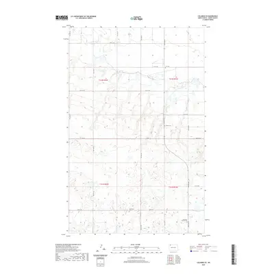
2020 Map of Columbus SE
USGS Topo · Published 2020About this map
Small country cemeteries and a grid of rural section lines characterize this portion of Burke County. The landscape is defined by the transitions between t162n r94w and t162n r93w, where local history is preserved in several small burial grounds. Among these are Bethlehem Lutheran Cem, Buckneberg Cem, and Bethany Cem, which anchor the sparse settlement patterns of this prairie region. Modern infrastructure follows the traditional Public Land Survey System, with Co Rd 6 and a network of gravel roads like 98th St NW and 95th Ave NW connecting the various farmsteads. The topography shows subtle drainage patterns and wetlands typical of the North Dakota plains, including the area near Fern Cem in the northern reaches of the quadrangle.
Find a feature on this map
22 named features on this map. Tap any name to fly to it.
Don’t see what you’re looking for? This feature index may not catch every label — zoom into the map to look around manually.
Map Details
Editions of this 2020 Columbus SE Map
This is the sole edition of this map. No revisions or reprints were ever made.
Other maps of this area

1947 · Columbus
USGS Topo · 1:24,000

1948 · Beaver Lake
USGS Topo · 1:24,000

1948 · Stampede
USGS Topo · 1:24,000

1949 · Columbus SW
USGS Topo · 1:24,000

1949 · Atcoal
USGS Topo · 1:24,000

1949 · Columbus
USGS Topo · 1:24,000

1949 · Columbus SE
USGS Topo · 1:24,000

1950 · Columbus
USGS Topo · 1:62,500

1950 · Portal
USGS Topo · 1:62,500

1953 · Williston
USGS Topo · 1:250,000