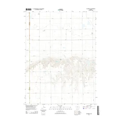
2014 Map of Columbus SE
USGS Topo · Published 2014About this map
The rolling hills and agricultural plains of Polk and Butler counties define this rural landscape south of the Platte River valley. The terrain is marked by a series of artificial impoundments, including the cluster of Bellwood Reservoir 3-A, Bellwood Reservoir 3-B, and Bellwood Reservoir 3-C, along with the Gruenewald Reservoir. These water management features are deeply integrated into the section-line road grid that characterizes Nebraska's interior farm country. For local historians and genealogists, the map identifies several significant burial grounds located along these gravel routes, most notably Saint Joseph Cem, Bellwood Cem, and Pleasant View Cem. The presence of Wilson Cr and Clear Cr highlights the natural drainage patterns that these engineered reservoirs were built to supplement or control within the productive agrarian environment.
Find a feature on this map
35 named features on this map. Tap any name to fly to it.
Don’t see what you’re looking for? This feature index may not catch every label — zoom into the map to look around manually.
Map Details
Editions of this 2014 Columbus SE Map
This is the sole edition of this map. No revisions or reprints were ever made.
Other maps of this area

1899 · David City
USGS Topo · 1:125,000

1955 · Fremont
USGS Topo · 1:250,000

1957 · Fremont
USGS Topo · 1:250,000

1958 · Fremont
USGS Topo · 1:250,000

1958 · Duncan
USGS Topo · 1:24,000

1958 · Columbus SW
USGS Topo · 1:24,000

1958 · Columbus SE
USGS Topo · 1:24,000

1958 · Columbus
USGS Topo · 1:24,000
1965 · Shelby
USGS Topo · 1:24,000
1965 · Garrison
USGS Topo · 1:24,000