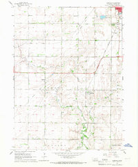
1965 Map of Garrison
USGS Topo · Published 1967About this map
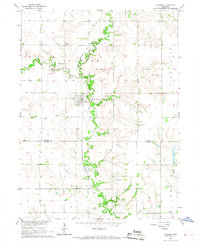
David City serves as the prominent hub in the northeastern corner of this Butler County landscape, where the Chicago and North Western and Union Pacific Railroad lines intersect. The 1960s terrain is defined by the winding course of the Little Blue River and Kezan Creek, which cut through a grid of section lines dotted with rural institutions. Local history is deeply embedded in the distribution of family-named schools like West Olive Sch and East Olive Sch, alongside several parish landmarks including Immanuel Ch and its accompanying Immanuel Ch Cem. The presence of both the David City Municipal Airport and the privately named Bongers Sky Ranch Airfield illustrates the evolving mid-century transportation needs of this agricultural region. Smaller settlements like Garrison and Millerton provide specific points of interest for genealogists tracing the development of small-town Nebraska before further consolidation.
Find a feature on this map
26 named features on this map. Tap any name to fly to it.
Don’t see what you’re looking for? This feature index may not catch every label — zoom into the map to look around manually.
Map Details
Editions of this 1965 Garrison Map
This is the sole edition of this map. No revisions or reprints were ever made.
Other maps of this area

1899 · David City
USGS Topo · 1:125,000

1955 · Fremont
USGS Topo · 1:250,000

1957 · Fremont
USGS Topo · 1:250,000

1958 · Fremont
USGS Topo · 1:250,000

1958 · Columbus SE
USGS Topo · 1:24,000
1965 · Brainard
USGS Topo · 1:24,000
1965 · Rising City
USGS Topo · 1:24,000
1966 · Dwight
USGS Topo · 1:24,000
1966 · Ulysses
USGS Topo · 1:24,000
1966 · Surprise
USGS Topo · 1:24,000