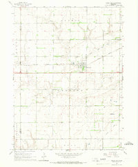
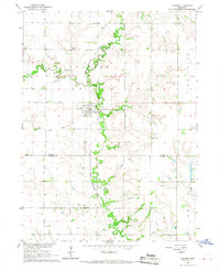
1965 Map of Rising City
USGS Topo · Published 1967About this map
The agricultural landscape of eastern Nebraska is anchored by Rising City, a settlement defined by the geometric precision of the Union Pacific railroad and the meandering course of the Little Blue River. This 1965 field-checked survey reveals a rural community where the transition from high-ground townships like Summit to the southern Read and Reading areas is marked by a network of sectional roads and family-owned farmsteads. Local history is deeply etched into the land through its spiritual and memorial sites, including St Johns Ch and three distinct burial grounds: Fairview Cem, Circle Mound Cem, and Rising Sun Cem. The presence of an Old Railroad Grade in the southeast corner provides a clear indication of shifting transportation patterns in the mid-20th century as the rail economy evolved.
Find a feature on this map
18 named features on this map. Tap any name to fly to it.
Don’t see what you’re looking for? This feature index may not catch every label — zoom into the map to look around manually.
Map Details
Editions of this 1965 Rising City Map
This is the sole edition of this map. No revisions or reprints were ever made.
Other maps of this area

1899 · David City
USGS Topo · 1:125,000

1955 · Fremont
USGS Topo · 1:250,000

1957 · Fremont
USGS Topo · 1:250,000

1958 · Fremont
USGS Topo · 1:250,000

1958 · Columbus SW
USGS Topo · 1:24,000

1958 · Columbus SE
USGS Topo · 1:24,000
1965 · Gresham
USGS Topo · 1:24,000
1965 · Shelby
USGS Topo · 1:24,000
1965 · Garrison
USGS Topo · 1:24,000
1966 · Ulysses
USGS Topo · 1:24,000