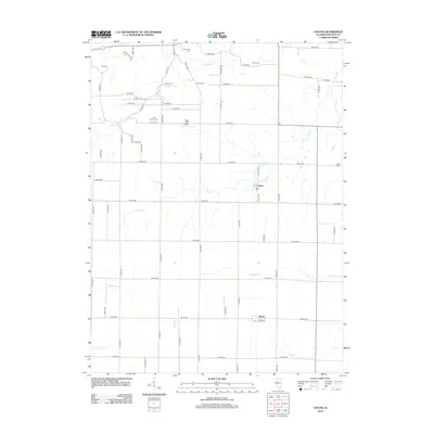
2012 Map of Colusa
USGS Topo · Published 2012About this map
The village of Colusa and the community of Adrian anchor this agricultural landscape in Hancock County, Illinois. The terrain is defined by a dense grid of rural roads and the meandering paths of several drainage systems, most notably Camp Cr, Spillman Cr, and Tilton Cr. These waterways create a irregular, natural contrast to the structured township and range grid system. Genealogists will find significant value in the distribution of family and local burial grounds across the township, including Tull Cem, Pontoosuc Cem, Myers Cem, Harris Cem, Little Family Cem, and Byley Cem. The presence of the Rhea RLA Airport and a central post office in Colusa highlights the essential infrastructure serving this prairie region. The map captures the quiet, persistent character of rural Illinois life in the early 21st century.
Find a feature on this map
62 named features on this map. Tap any name to fly to it.
Don’t see what you’re looking for? This feature index may not catch every label — zoom into the map to look around manually.
Map Details
Editions of this 2012 Colusa Map
This is the sole edition of this map. No revisions or reprints were ever made.
Other maps of this area

1932 · Lomax
USGS Topo · 1:62,500

1933 · Carthage
USGS Topo · 1:62,500

1936 · Keokuk
USGS Topo · 1:62,500

1936 · Fort Madison
USGS Topo · 1:62,500

1937 · Carthage
USGS Topo · 1:62,500

1937 · Lomax
USGS Topo · 1:62,500

1950 · Keokuk
USGS Topo · 1:62,500

1958 · Burlington
USGS Topo · 1:250,000

1961 · Burlington
USGS Topo · 1:250,000

1963 · Burlington
USGS Topo · 1:250,000