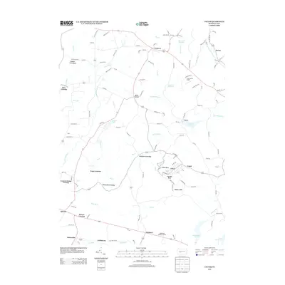
2013 Map of Colver
USGS Topo · Published 2013About this map
Colver and its distinctive neighborhood clusters of Nine Row and Twenty Row anchor this portion of Cambria County, reflecting the organized layout of a 20th-century industrial community. To the north, Nicktown sits at a crossroads near Moss Creek, while the southern reaches feature the Pindleton Lookout Tower and settlements like Belsano and Bakersville. The landscape is heavily defined by its water resources and reservoirs, including the Browns Run Reservoir, Colver Reservoir, and the larger Williams Run Reservoir. Numerous named crossings, such as Kinter Crossing and Edwards Crossing, suggest a history of vital local passage points over the many branches of Elk Creek and the North Branch Blacklick Creek.
Find a feature on this map
125 named features on this map. Tap any name to fly to it.
Don’t see what you’re looking for? This feature index may not catch every label — zoom into the map to look around manually.
Map Details
Editions of this 2013 Colver Map
This is the sole edition of this map. No revisions or reprints were ever made.
Other maps of this area

1902 · Ebensburg
USGS Topo · 1:62,500

1902 · Patton
USGS Topo · 1:62,500

1902 · Barnesboro
USGS Topo · 1:62,500

1904 · Barnesboro
USGS Topo · 1:62,500

1904 · Patton
USGS Topo · 1:62,500

1904 · Ebensburg
USGS Topo · 1:62,500

1904 · Johnstown
USGS Topo · 1:62,500

1907 · Johnstown
USGS Topo · 1:62,500

1943 · Punxsutawney
USGS Topo · 1:125,000

1953 · Pittsburgh
USGS Topo · 1:250,000
Featured Places
- Bakersville, Cambria Township
- Pine Township, PA
- Twenty Row, Cambria Township
- Nine Row, Cambria Township
- Nicktown, Barr Township