1950 Map of Comanche Spring
USGS Topo · Published 1968About this map
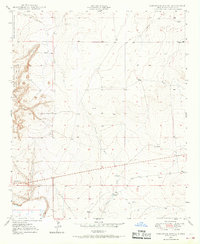
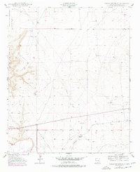
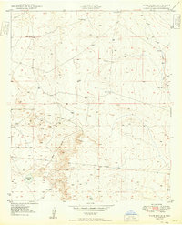
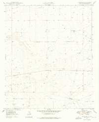
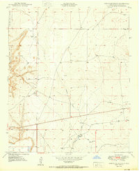
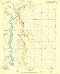
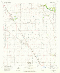
Comanche Spring serves as a critical water source in this arid Chaves County landscape, documented during a mid-century period when traditional ranching infrastructure relied heavily on scattered water developments. The terrain is characterized by the prominent elevation of Comanche Hill and the seasonal drainage of Comanche Draw, which winds through the eastern portion of the survey. To the west, the boundary of the Bitter Lake National Wildlife Refuge marks a significant protected area along the Pecos River basin. A network of ranching activity is evident through numerous Windmills and a prominent Pipe Line that cuts across the southern quadrants, illustrating the logistical efforts required to manage livestock in the high desert. The map also identifies the Triple landmark, providing a specific point of reference for researchers tracing land use and historical property boundaries in this transition zone.
Find a feature on this map
9 named features on this map. Tap any name to fly to it.
Don’t see what you’re looking for? This feature index may not catch every label — zoom into the map to look around manually.
Map Details
Editions of this 1950 Comanche Spring Map
Other maps of this area
1949 · Wade Ranch
USGS Topo · 1:24,000
1949 · L-E Ranch
USGS Topo · 1:24,000
1950 · Comanche Spring
USGS Topo · 1:24,000
1950 · Bottomless Lakes
USGS Topo · 1:24,000

1950 · South Spring
USGS Topo · 1:24,000

1950 · Bitter Lake
USGS Topo · 1:24,000

1955 · Roswell
USGS Topo · 1:250,000

1958 · Roswell
USGS Topo · 1:250,000

1962 · Roswell
USGS Topo · 1:250,000
1962 · South Spring
USGS Topo · 1:24,000