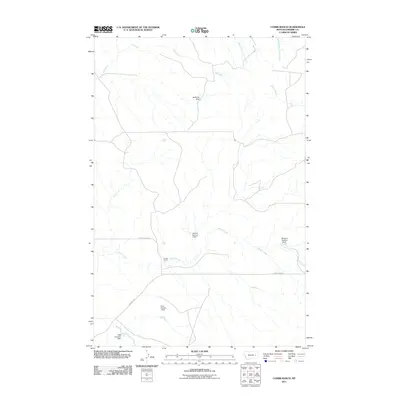
2011 Map of Combs Ranch
USGS Topo · Published 2011About this map
Combs Ranch anchors this portion of Prairie County, where the landscape is defined by the strategic management of water across the Montana plains. The reliance on small-scale hydraulic engineering is evident in the numerous earthen structures found here, including the McMullin Dam and the Pfaff Irrigation Dam. These features, alongside the Janitell Number 1 Dam and McDevlin Number 1 Dam, suggest a pattern of localized ranching and agricultural endurance in a region where seasonal flows from Ash Creek and Whites Creek must be captured to sustain the land. Remote access to these homesteads and water works is provided by the winding paths of Cherry Creek Rd and Deadman Rd, which traverse the coulees and drainages leading toward the forks of Timber Creek.
Find a feature on this map
14 named features on this map. Tap any name to fly to it.
Don’t see what you’re looking for? This feature index may not catch every label — zoom into the map to look around manually.
Map Details
Editions of this 2011 Combs Ranch Map
This is the sole edition of this map. No revisions or reprints were ever made.
Other maps of this area

1953 · Miles City
USGS Topo · 1:250,000

1954 · Jordan
USGS Topo · 1:250,000

1954 · Forsyth
USGS Topo · 1:250,000

1954 · Glendive
USGS Topo · 1:250,000

1956 · Jordan
USGS Topo · 1:250,000

1957 · Miles City
USGS Topo · 1:250,000

1957 · Glendive
USGS Topo · 1:250,000

1957 · Forsyth
USGS Topo · 1:250,000

1958 · Miles City
USGS Topo · 1:250,000

1958 · Jordan
USGS Topo · 1:250,000