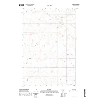
2020 Map of Combs Ranch
USGS Topo · Published 2020About this map
Combs Ranch anchors this portion of Prairie County, situated in a high plains landscape defined by an intricate network of seasonal drainages. The area is characterized by the convergence of multiple creek systems, including Whites Cr, Cherry Cr, and Ash Cr, which carve through the terrain between established cattle country routes. Modern transportation is represented by Cherry Creek Rd and the aptly named Deadman Rd, which provide access through the sprawling ranchlands. This survey illustrates the persistent importance of water sources and family-held land in eastern Montana, where life and commerce revolve around the drainage basins of Middle Fork Timber Cr and the distant Finley Cr.
Find a feature on this map
14 named features on this map. Tap any name to fly to it.
Don’t see what you’re looking for? This feature index may not catch every label — zoom into the map to look around manually.
Map Details
Editions of this 2020 Combs Ranch Map
This is the sole edition of this map. No revisions or reprints were ever made.
Other maps of this area

1953 · Miles City
USGS Topo · 1:250,000

1954 · Jordan
USGS Topo · 1:250,000

1954 · Forsyth
USGS Topo · 1:250,000

1954 · Glendive
USGS Topo · 1:250,000

1956 · Jordan
USGS Topo · 1:250,000

1957 · Miles City
USGS Topo · 1:250,000

1957 · Glendive
USGS Topo · 1:250,000

1957 · Forsyth
USGS Topo · 1:250,000

1958 · Miles City
USGS Topo · 1:250,000

1958 · Jordan
USGS Topo · 1:250,000