
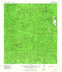
1940 Map of Cometa
USGS Topo · Published 1958About this map
Cometa and its surrounding ranch lands appear here as they were just before the mid-century, situated where the high plains of Southwest Texas meet the brush country. This landscape is defined by its extensive network of seasonal drainages, including Chacon Creek and Comanche Creek, which shaped the placement of large cattle operations. The map documents a sparsely populated but active ranching economy, identifying individual holdings such as the Chimeneas Ranch and Sullivan Ranch, alongside the homes of local figures like M E Ware and C L Van Cleve.
Find a feature on this map
23 named features on this map. Tap any name to fly to it.
Don’t see what you’re looking for? This feature index may not catch every label — zoom into the map to look around manually.
Map Details
Editions of this 1940 Cometa Map
2 editions found
Other maps of this area

1929 · Cotulla
USGS Topo · 1:125,000

1939 · Carrizo Springs
USGS Topo · 1:62,500

1939 · La Pryor
USGS Topo · 1:62,500

1940 · Asherton
USGS Topo · 1:62,500

1940 · Eagle Pass
USGS Topo · 1:62,500

1940 · Paloma
USGS Topo · 1:62,500

1940 · Chacon Creek
USGS Topo · 1:62,500

1941 · Botella Creek
USGS Topo · 1:62,500

1953 · Crystal City
USGS Topo · 1:250,000

1955 · Crystal City
USGS Topo · 1:250,000