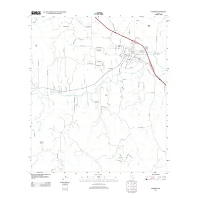
2013 Map of Comfort
USGS Topo · Published 2013About this map
The Comfort Historic District serves as the heart of this Kendall County landscape, where the Guadalupe River meets Cypress Cr. This 2013 survey illustrates a region with deep German heritage, anchored by the Treue der Union monument and a high concentration of fraternal and family burial sites, including the Steves Family Cem and Hermann Sons Cem. The town's layout is defined by the intersection of traditional community spaces and modern infrastructure, with the Santiago Cattle Co. Airport and Comfort Airpark positioned near established residential areas.
Find a feature on this map
90 named features on this map. Tap any name to fly to it.
Don’t see what you’re looking for? This feature index may not catch every label — zoom into the map to look around manually.
Map Details
Editions of this 2013 Comfort Map
This is the sole edition of this map. No revisions or reprints were ever made.
Other maps of this area

1894 · Fredericksburg
USGS Topo · 1:125,000

1894 · Kerrville
USGS Topo · 1:125,000

1954 · Llano
USGS Topo · 1:250,000

1954 · San Antonio
USGS Topo · 1:250,000

1955 · Llano
USGS Topo · 1:250,000

1956 · Comfort
USGS Topo · 1:62,500

1956 · Center Point
USGS Topo · 1:62,500

1956 · Llano
USGS Topo · 1:250,000

1957 · San Antonio
USGS Topo · 1:250,000

1964 · Comfort
USGS Topo · 1:24,000