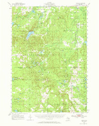
1955 Map of Comins
USGS Topo · Published 1970About this map
The boundary between Montmorency and Oscoda counties bisects a landscape defined by state and federal forest lands, including the Thunder Bay River State Forest and the Huron National Forest. In the mid-1950s, this region was a quiet network of small settlements and recreational areas. The village of Comins serves as a local hub near the Au Sable State Forest, while the presence of the Sheridan Valley Ski Area and numerous lakes like Avery Lake, Sage Lakes, and Little Grass Lake points to the area's established role in Northern Michigan tourism and outdoor life. Genealogists and local historians can trace legacy landmarks such as the Finnish Cem, Loud Cem, and the Loud Sch, which offer a glimpse into the community's social fabric during this era. The map also records early infrastructure like the Lockwood Lake Road and Greely Road, connecting remote homesteads and seasonal camps across the wooded terrain.
Find a feature on this map
65 named features on this map. Tap any name to fly to it.
Don’t see what you’re looking for? This feature index may not catch every label — zoom into the map to look around manually.
Map Details
Editions of this 1955 Comins Map
2 editions found

Other maps of this area

1949 · Lewiston
USGS Topo · 1:62,500

1950 · Lewiston
USGS Topo · 1:24,000

1950 · Comstock Hills
USGS Topo · 1:24,000

1951 · Comstock Hills
USGS Topo · 1:24,000

1951 · Lewiston
USGS Topo · 1:24,000

1954 · Hetherton
USGS Topo · 1:62,500

1954 · Traverse City
USGS Topo · 1:250,000

1954 · Tawas City
USGS Topo · 1:250,000

1954 · Alpena
USGS Topo · 1:250,000

1955 · Atlanta
USGS Topo · 1:62,500