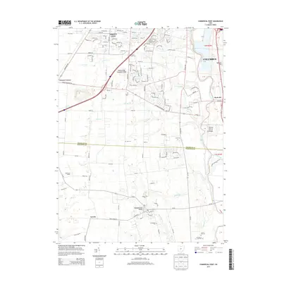
2013 Map of Commercial Point
USGS Topo · Published 2013About this map
The Scioto River valley south of Columbus serves as a geographic anchor for this 2013 survey of the Franklin and Pickaway county border. The landscape reflects a mix of suburban growth and deeply rooted agricultural heritage, visible in the preservation of numerous family and farm cemeteries. To the north, Grove City and its Grove City Country Club mark the advancing edge of development, while to the south, smaller communities like Commercial Point, Matville, and Pleasant Corners maintain their rural character. The map identifies several historical burial grounds including the Thomas Adams Cem, Caldwell Farm Cem, and James Borrer Farm Cem, providing vital clues for genealogists tracking local families along the banks of Plum Run and Peters Run. These features, combined with the presence of Big Walnut Creek, offer a detailed look at the drainage patterns and land divisions that have shaped these central Ohio townships.
Find a feature on this map
101 named features on this map. Tap any name to fly to it.
Don’t see what you’re looking for? This feature index may not catch every label — zoom into the map to look around manually.
Map Details
Editions of this 2013 Commercial Point Map
This is the sole edition of this map. No revisions or reprints were ever made.
Other maps of this area

1911 · Era
USGS Topo · 1:62,500

1913 · Era
USGS Topo · 1:62,500

1914 · Circleville
USGS Topo · 1:62,500

1923 · West Columbus
USGS Topo · 1:62,500

1925 · East Columbus
USGS Topo · 1:62,500

1925 · West Columbus
USGS Topo · 1:62,500

1943 · Era
USGS Topo · 1:62,500

1943 · Circleville
USGS Topo · 1:62,500

1943 · East Columbus
USGS Topo · 1:62,500

1947 · Columbus
USGS Topo · 1:250,000