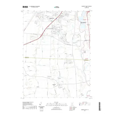
2019 Map of Commercial Point
USGS Topo · Published 2019About this map
The Scioto River and Big Walnut Creek corridors define the eastern edge of this landscape, where the sprawling suburban growth of Grove City and Columbus meets the rural agricultural fields of the Franklin and Pickaway county line. This map details a high concentration of family and community burial grounds, such as Seeds Cem, Concord Cem, and the Caldwell Farm Cem, which reflect the area's deep-rooted pioneer history. The central portion of the sheet is characterized by numerous watercourses like Grant Run and Plum Run that drain toward the river, interspersed with modern landmarks like Millertime Airport and the Grove City Country Club. The settlement pattern transitions from the dense residential streets of Grove City in the north to the quieter locales of Matville and Commercial Point to the south.
Find a feature on this map
140 named features on this map. Tap any name to fly to it.
Don’t see what you’re looking for? This feature index may not catch every label — zoom into the map to look around manually.
Map Details
Editions of this 2019 Commercial Point Map
This is the sole edition of this map. No revisions or reprints were ever made.
Other maps of this area

1911 · Era
USGS Topo · 1:62,500

1913 · Era
USGS Topo · 1:62,500

1914 · Circleville
USGS Topo · 1:62,500

1923 · West Columbus
USGS Topo · 1:62,500

1925 · East Columbus
USGS Topo · 1:62,500

1925 · West Columbus
USGS Topo · 1:62,500

1943 · Era
USGS Topo · 1:62,500

1943 · Circleville
USGS Topo · 1:62,500

1943 · East Columbus
USGS Topo · 1:62,500

1947 · Columbus
USGS Topo · 1:250,000