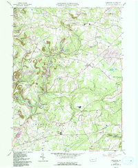
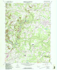
1961 Map of Commodore
USGS Topo · Published 1993About this map
The northern reaches of Indiana County in the early 1960s are defined by a complex mosaic of rural crossroads and industrial footprints. Along the North Branch of Two Lick Creek, the settlements of Starford and Commodore sit amidst a landscape marked by coal extraction and subsequent recovery, evidenced by the scattered Mine sites and sections of Reclaimed Strip Mine found nearby. The mapping reveals a distinct distribution of community landmarks, from the Brick Kilns near Diamondville to the Clymer Fire Tower overlooking the creek valleys.
Find a feature on this map
62 named features on this map. Tap any name to fly to it.
Don’t see what you’re looking for? This feature index may not catch every label — zoom into the map to look around manually.
Map Details
Editions of this 1961 Commodore Map
5 editions found
Other maps of this area

1902 · Indiana
USGS Topo · 1:62,500

1902 · Barnesboro
USGS Topo · 1:62,500

1904 · Barnesboro
USGS Topo · 1:62,500

1906 · Punxsutawney
USGS Topo · 1:62,500

1909 · Smicksburg
USGS Topo · 1:62,500

1938 · Smicksburg
USGS Topo · 1:62,500

1939 · Smicksburg
USGS Topo · 1:62,500

1939 · Punxsutawney
USGS Topo · 1:62,500

1942 · Punxsutawney
USGS Topo · 1:62,500

1943 · Punxsutawney
USGS Topo · 1:125,000
Featured Places
- Rayne Township, PA
- Jewtown, Pine Township
- East Mahoning Township, PA
- Montgomery Township, PA
- Grant Township, PA