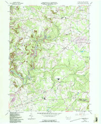
1961 Map of Commodore
USGS Topo · Published 1993About this map
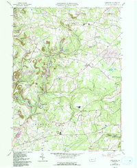
Commodore and the neighboring coal-era settlements of Starford, Heilwood, and Kenwood define this landscape within Greene and Cherryhill townships. The map documents an industrial transition, where traditional farming in the north gives way to significant reclaimed strip mine sites and active mines further south. The Purchase Line road and various rail junctions like Wandin Junction illustrate the transportation network that once moved resources from the local hills to larger markets. Educational and social centers like Penns Manor High Sch and Laurel Swamp Union Ch serve the clustered hamlets of Pine Flats and Manver Sta. Along the meandering Two Lick Creek and its tributaries, the map preserves the locations of early family-named places like Learn Settlement and Diamondville, providing a detailed view of the community structure in this part of Indiana County.
Find a feature on this map
65 named features on this map. Tap any name to fly to it.
Don’t see what you’re looking for? This feature index may not catch every label — zoom into the map to look around manually.
Map Details
Editions of this 1961 Commodore Map
5 editions found
Other maps of this area

1902 · Indiana
USGS Topo · 1:62,500

1902 · Barnesboro
USGS Topo · 1:62,500

1904 · Barnesboro
USGS Topo · 1:62,500

1906 · Punxsutawney
USGS Topo · 1:62,500

1909 · Smicksburg
USGS Topo · 1:62,500

1938 · Smicksburg
USGS Topo · 1:62,500

1939 · Smicksburg
USGS Topo · 1:62,500

1939 · Punxsutawney
USGS Topo · 1:62,500

1942 · Punxsutawney
USGS Topo · 1:62,500

1943 · Punxsutawney
USGS Topo · 1:125,000
Featured Places
- Rayne Township, PA
- Jewtown, Pine Township
- East Mahoning Township, PA
- Montgomery Township, PA
- Grant Township, PA